Der Eintrag
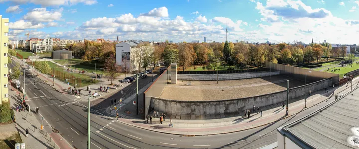
Der einzige Ort, an dem der Grenzstreifen in seiner ganzen Tiefe erhalten ist – Mauer, Boden, Sperren und Turmstandorte in einem bewahrten Querschnitt.
Die ausführliche Geschichte, die Herkunft und die Quellenangaben dieses Eintrags liegen bislang nur auf Englisch vor.
About 1.4 km of memorial grounds along Bernauer Straße, of which roughly 60 m is preserved as a complete cross-section of the border: the wall itself, the raked ground behind it, the obstacles and the positions of the towers. Nowhere else survives in that depth. Bernauer Straße is where the buildings stood on the eastern side and the pavement on the western, so people jumped from windows in August 1961 while the doors below were bricked up — which is why this street, of the 43 km that cut through the city, is the one that was argued for and kept.
Wie kam es hierher?
Original position. Almost nothing in Berlin survives because anyone decided to keep it: demolition ran through 1990 and was close to total, and the preserved sections are the ones fought for afterwards.
Quellen
Sites — Stiftung Berliner Mauer (Berlin Wall Foundation) ↗
The Foundation's own listing of the sites it runs and documents, with addresses and what survives at each.
Institutionelle QuelleQuelle abgerufen am 2026-09-17
The Berlin Wall — Stiftung Berliner Mauer ↗
The border ran 155 km around West Berlin, of which roughly 43 km cut through the city.
Institutionelle QuelleQuelle abgerufen am 2026-09-17
Wissen Sie mehr über dieses Stück – wann es ankam, wer es gab, was auf der Tafel steht? Zu diesem Eintrag beitragen (Englisch)