Der Eintrag
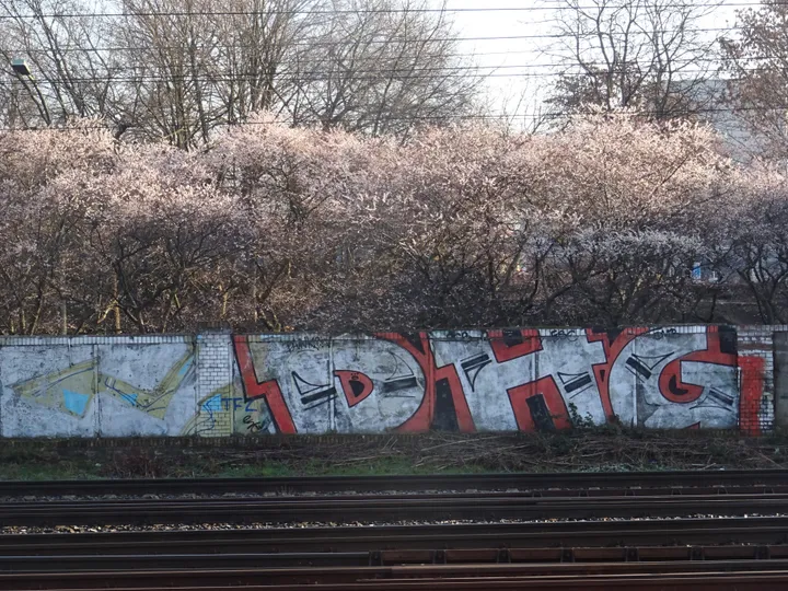
Eine Eisenbahnmauer von 1900, die 1961 in die Grenze einbezogen wurde, und eine gekrümmte Plattenmauer, gebaut zum Schutz einer Bahnstrecke, die die Mauer selbst erst nötig gemacht hatte.
Die ausführliche Geschichte, die Herkunft und die Quellenangaben dieses Eintrags liegen bislang nur auf Englisch vor.
South of the Bornholmer Straße crossing, around the Nordkreuz railway junction, the border was awkward to secure because of the tracks, so the fortifications enclosed a wide area. Sections of the walls built here still stand on Norweger Straße and Behmstraße and were listed as monuments in 2005.
The stretch along Norweger Straße, from Finnländische Straße to Behmstraße, was not built as a border at all. It went up in 1900 to protect the railway installations, and in 1961 it was simply absorbed into the Wall. That is a pattern worth naming, because it recurs: at the Nordbahnhof a station wall of 1895 was taken over the same way, and at the Invalidenfriedhof a cemetery wall of 1902. The Wall was not built from nothing. Where something already stood in the right line, the GDR used it.
The curved slab wall that follows the S-Bahn tracks between Behmstraße and Malmöer Straße records a second-order consequence. The sector boundary here ran along the railway embankment, and the Wall of 13 August 1961 cut the line between Gesundbrunnen in the west and Bornholmer Straße and Pankow in the east. Bornholmer Straße station was closed and a two-metre fence put up between the tracks. In the same month the transport ministry approved a new stretch of S-Bahn between Pankow and Schönhauser Allee running entirely on East Berlin territory; it opened on 10 December 1961 and was known colloquially as the Ulbricht curve. Because the new line ran so close to the border, further barriers had to be built in front of the border fortifications proper — and the curved concrete slab wall that resulted still flanks the S-Bahn today.
Wie kam es hierher?
In place. Listed as monuments in 2005. The Norweger Straße wall was built in 1900 to protect railway installations and absorbed into the border fortifications in 1961.
Quellen
Norweger Straße und Behmstraße — Landesdenkmalamt Berlin, Wall monuments ↗
The difficulty of securing the border around Nordkreuz and the resulting wide fortifications, the surviving wall sections on Norweger Straße and Behmstraße listed in 2005, the 1900 railway wall absorbed into the border in 1961, the severing of the railway connections on 13 August 1961 and the closure of Bornholmer Straße station, the two-metre fence between the tracks, the approval and opening of the Ulbricht curve on 10 December 1961, and the additional slab wall built in front of the border fortifications.
Institutionelle QuelleQuelle abgerufen am 2026-09-17
Wissen Sie mehr über dieses Stück – wann es ankam, wer es gab, was auf der Tafel steht? Zu diesem Eintrag beitragen (Englisch)